GIS and data management
Geographic Information Systems (GIS) store, manage and process spatial data – images with coordinates. Operations applied to such geospatial images might include cutting, extraction and reprojections in order to match with other reference data. The technical knowledge allows us to develop better map products, such as land cover maps, forest maps, or to setup monitoring systems.
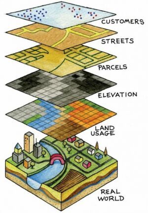
Examples on how different map layers can be combined in a GIS system