Terrestrial laser scanning
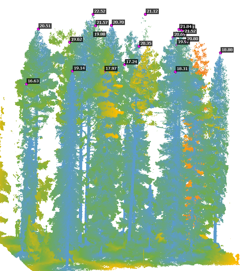
TLS based point cloud with maximum height estimated for the tops.
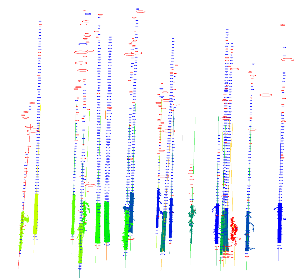
Single tree trunks delineated from dense TLS data. Blue circles indicate fitted circles, red circles are outliers, and the color sections at the bottom of the stems are the critical sections used identify them as individual trees.
Terrestrial means the laser scanner (TLS) is ground based, but it still relies on the same technique as airborne laser scanning. The point density is however very high and depending on the time used for each scan, a full 360 degrees round scan can take about 30 s up to 10 min. The generated datasets are excellent reference data for evaluating other remote sensing techniques. TLS scanners have shown very high precision and are widely used in different applications, e.g. civil engineering and forest research.